[ad_1]
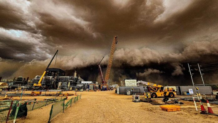
A FIFO worker has captured the extraordinary moment a menacing looking sandstorm enveloped a work site in outback South Australia.
“You could just see it coming and you just thought ‘this is not going to be good’,” Dylan Barlow said on the storm which hit Moomba, in the state’s far north east.
The sandstorm is just one of the many effects attributed to ex-Tropical Cyclone Kirrily.
While it reduced from cyclone strength last week, it has continued to weave its way through central and eastern Australia.
Meteorologists have said that Tuesday could see heavy rain over a large swath of New South Wales and the ACT has Kirrily crosses the state and heads out into the Tasman.
Sydney, Wollongong and Canberra could all be wet with up to 100mm falling in just 24 hours in some central and southern parts of NSW.
A fly-in, fly-out worker, Mr Barlow works at the Moomba gas plant operated by resource extraction firm Santos.
The rigger said the storm, which featured roiling black clouds, headed across the plant at around 1.45pm on Sunday.
“It was 42C and then suddenly the temperatures dropped,” Mr Barlow told The Advertiser.
“The winds picked up and then these dark clouds appeared. We had to race to get inside so you weren’t hit with it.
“You couldn’t see right in front of you, it was that thick.”
Mr Barlow said winds of as much as 90km/h raced through the site for around one hour. That was then followed by torrential rain for the next four hours, he said.
The Bureau of Meteorology (BOM) recorded a gust of 89 km/h at Moomba Airport at 2pm on Sunday and 24 hour rainfall of 62mm to 9am on Monday.
The temperature went from a blistering 38.9C at 1.30pm to 24.7C at 2pm.
Ex-tropical cyclone Kirrily is now over NSW with the BOM putting out a severe weather warning for heavy rainfall which could lead to flash flooding for Tuesday.
Kirrily’s path over the state begins in north east NSW overnight and then will track south easterly, through the central West towards Canberra and just south of Sydney, through the day.
Six-hourly rainfall totals between 50 and 80mm are likely, with 24-hourly totals between 70 and 100mm also possible.
The BOM has said that there could be particularly intense rainfall that could lead to “dangerous and life threatening flash flooding” in an areas west of Parkes where possibly 150mm could come down.
Canberra is looking sodden for Tuesday with 10-45mm coming down and a chance of thunderstorms. The rain should clear by the evening.
It won’t be as wet in Sydney but up to 15, on Tuesday and 10mm on Wednesday is possible.
Areas south of Sydney are right in the line of the low. Wollongong could see 5-20mm of rain on Tuesday, Nowra 15-40mm and Batemans Bay up to 45mm.
[ad_2]
Source link


