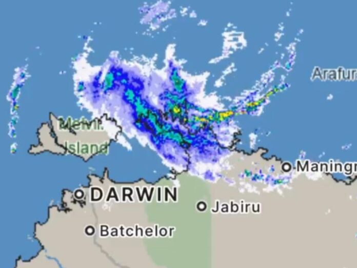
Tropical Cyclone Fina is on track to become the first category 3 cyclone to form in Australian waters during November since Cyclone Bertie-Alvin in 2005. Meteorologists say this intensification could occur as early as Friday evening.
Over the past two decades, six November cyclones have developed in Australian waters, but none have reached category 3 strength — the threshold where a system becomes a severe tropical cyclone with gusts between 165–224 km/h.
Current Status of Cyclone Fina
Fina briefly weakened to category 1 on Thursday and slowed down about 100 km off the Northern Territory’s north coast. By 9:30 am ACST on Friday, it sat 325 km northeast of Darwin, with sustained winds of 85 km/h and gusts up to 120 km/h.
Meteorologists expect conditions to become more favourable throughout Friday, likely allowing Fina to regain category 2 intensity and possibly strengthen further.
Projected Path and Wind Impact
Fina is expected to cross over the Cobourg Peninsula and Tiwi Islands between Friday night and early Saturday, mostly as a category 2 system with damaging winds that could reach 155 km/h.
The Bureau of Meteorology warns that destructive gusts up to 155 km/h may hit areas between Cape Don and Warruwi later today, with the Tiwi Islands seeing similar impacts early Saturday.
There is still a chance Fina could reach category 3 intensity late Friday or early Saturday, especially as it moves into the Van Diemen Gulf, where sea surface temperatures sit around 30°C — warmer than usual for this time of year.
Will Darwin Be Affected?
Fina is forecast to pass near or directly over Darwin on Saturday night into Sunday morning. The city could experience destructive wind gusts up to 155 km/h, along with heavy rain and potential flash flooding.
Rainfall totals are expected to be significant:
100–300 mm widely across the northwest Top End
Isolated pockets may record up to 500 mm
What Happens After Darwin?
After passing the Top End, Fina is expected to move over the southern Timor Sea, where it may strengthen into a category 3 severe tropical cyclone on Sunday or Monday if it hasn’t already. Increasing wind shear early next week is likely to weaken the system as it nears the north Kimberley coast.


